The most southern hiking trail on the earth
Darwin was there, Magellan crossed it too. So, why don't we go there as well? We thought so in the early days of 2018 and started planning. A plan to go to the most southern civil - settled area of the earth: Tierra del Fuego.
The given name is not, because it's like the volcanic most active island of the world, like Iceland. Rumors say, that this name arose through a glance of Sir Magellan, who anchored his ship in the beginning of the 15th century between the islands of 'fireland' and todays mainland of Chile. Magellan saw small fires on the opposite side of the mainland, ignited by the indigenous population at their villages and on the coast. He named this island 'land of fire' - fireland because of that. And the name still remains until today.
The time brought changes, nothing remained the same, details will not be explained here as it should be a report of a travel to this place, more or less exactly 500 years later.
The five of us: Benno, Finn, Christian, Matthias and I flew the long way from Europe down to the most southern 'civilized' spot of the earth. By watching a documantary during the flight of the exploitation, degredation and destruction of the earth through industry, population growth, farming and so further on - thinking, I'm sitting in an trans - Atlantic flight and going about 15 000 km across the earth isn't much better as industrial processes shown in the movie. It's by far to cheap, to go by an airplane across the world for a lot of people, of course. But this should not be a topic in the further read, but much more a remaining thought for our all future.
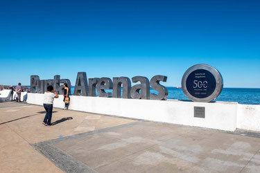
Enough said, we had a brilliant flight, no problems at all and arrived healthy the Isla Navarino and the town Puerto Williams (going with stops from Germany over Toronto (CA), Santiago de Chile (CL) and Punta Arenas (CL)). The Isla Navarino is the most south - eastern island of Tierra del Fuego and controlled by the chileanian military. By the way, Ushuaia in Argentinia is not the most southern city in the world, it's Puerto Williams.


The Dientes de Navarino Trail (06.02.-11.02.2019)
Shopping in the most southern small supermarket for food for the upcoming 7 days hike was fun and expensive. Each of us carried about 3 to 7 kg of food (common stuff and individual), made up of pasta, rice, peanuts, oat, cookies, spices (all types, they offered in the supermarket); more or less, that's it. Very rough and simple, and brought the necessary energy for our trip.
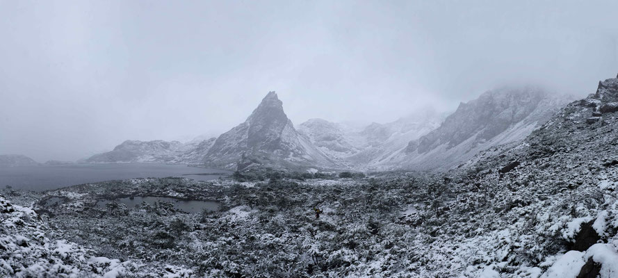
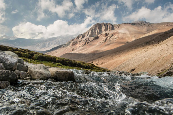
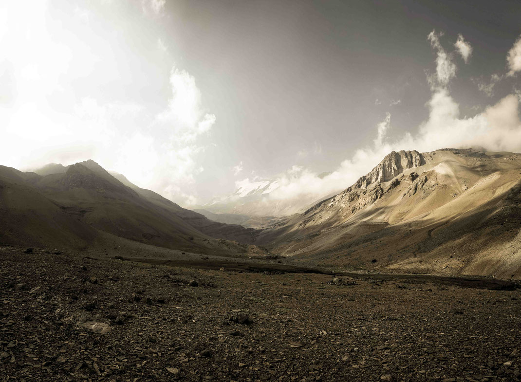
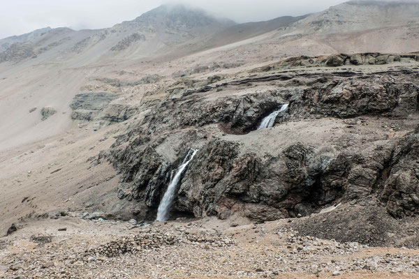
On a Wednesday, we started our the circulation of the Isla Navarino along the trail Dientes de Navarino. There are several routes, heading to the most southern spot (Lago Windhond), we
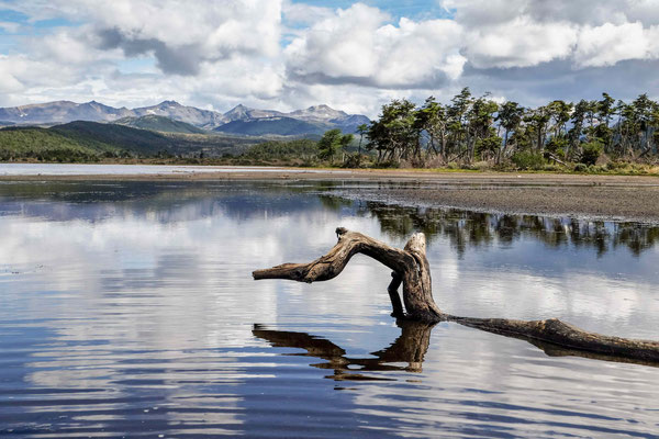
took the scenic path, passing by Lago de Salto, over the hills ("... and far away") of the Dientes Navarino (see picture below).


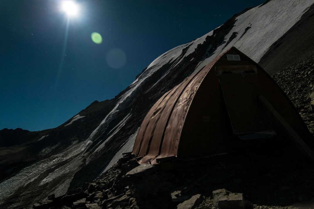
And only one day after our start from Pt. Williams, we arrived the Ref. Charles close to the Lago Windhond. Probably our most southern spot, we'll stay, of our lives (we will see ... (; ). The path to this wind shelter guided us over the appr. 650 m high crossings of the mountain passages in good and calm weather. Plus, we had to climb (not joking) down a very steep side wall of a former glacier moraine. We were battling steepness of the slope, I assume, it's been about 35 °. It wouldn't been so hard, if there would had been a gravel slope. But this slope was dense grown with a weird shaped - belonging to the Magellnic rainforest species. It took us 1, 5 h to go down this slope with a height difference of about 420 m (air distance from top to valley: ~ 1,2 km).
Soon after descend from the plateau, we crossed a wide area which is covered by the Magellanic mooreland (containing the Sphagnum magellanicum and Donatia fascicularis (Esfagnosa and Pulvinada Tundra)). The name of this Tundra said it, this Fauna is typical for the Isla Navarino (southern part) and might could be found only there in resp. to the rest of the world (except of boreal places in North America, South America and Eurasia).


We arrived at the Refuge Charles in the later evening. Two other groups of Chilean and French hikers (the typical type of hikers at the Island Navarino (; ) built there tents before us and captured the better places. A group of Russian hikers passed by later, but they had other priorities than staying at the Ref. Charles.
It was hard, to find a proper place above the root criss-crossed underground. Except these problems, we had no higher priorities than that for the moment: to find a good place to sleep and rest. Simple and straight - forward. A learning lesson for every human, I bet, to find the simple things and to conquer the basic problems in one life (of course, life isn't always that easy ...).
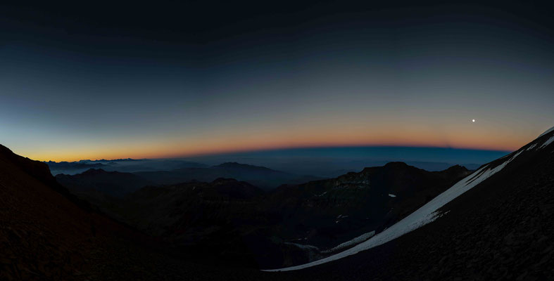
We had a nice fire at the night and a stunning cloudless and stars - sparkling sky. Which is typical for remote places like the Tierra de la fuego, or Hawaii, or northern Lappland, the Atacama dessert (etc.), to have no light pollution It's a rare sample of places in the world, where you have those phenomenons of a strong visible "milky way" as light pollution increases with increased population and urbanisation.
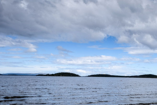
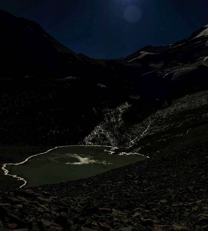
We found the most southern spot on earth, where we had been since the beginning of our lives at the Lago Windhond. Nothing spectacular. But, you can go into the end of the world slowly. Because, the Lago Windhond is a very shallow lake and very, very cold
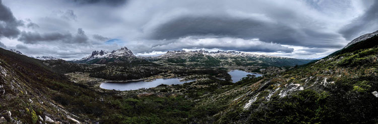
That's been it? More or less, it was our main goal, to reach the most southern spot of a hiking path of our earth. And we continued with our hike, only north in a more circular path to the west and to the east afterwards by circulating the Dientes Navarino mountains. We reached Puerto Williams at the 11.02., so three days after our stay at the Ref. Charles.
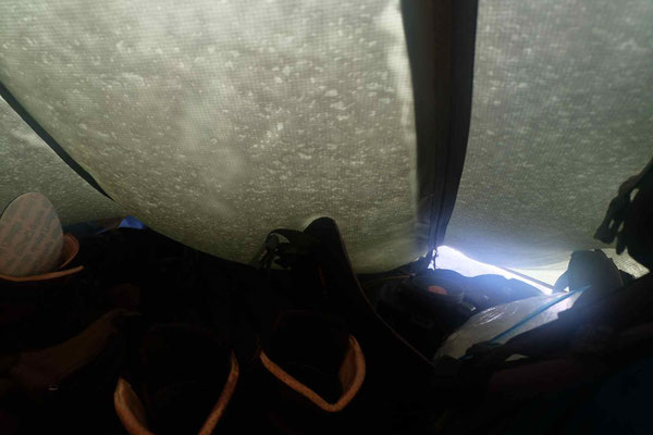
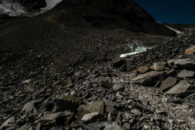
We encountered a spectacular Antarctic snow storm, whose surprised us during the night of the 10.02.. It was a stormy day anyway, the 10.02., fractured by sleet, snow flakes and a bit of rain. 'Bwoah', it was only wet and a (tiny) bit ugly, but totally worth it, to name this day one of the most adventures of the stay at the Isla Navarino. Some impressions can be found below.


The last kilometers back to Puerto Williams were persistent and had the typical fauna of the northern part of the Isla Navarino. This means, it is covered by a decidiuous Magellanic forrest. Especially the last slope, coming down from the Passo Virginia and directing to the strait of Magellan was just an endless path seeking through a wild forest.
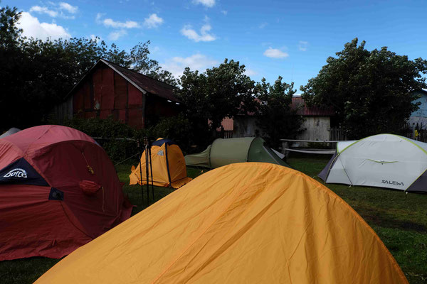
In the end, we arrived in the later evening, even with a hitch hike along the coast road pack to the town of Pt. Williams, we arrived 18:30 o'clock.
We enjoyed a great (beaver) pizza. The pizzeria was located close to the camp site in a "rustic" - typical housing of this town. Cecilia, the "good soul" of the camp site brought us back to the airport the other day, where we flew back to the north of Chile - to Santiago de Chile, to start our second adventure in going up the Cerro El Plomo.


Los Andes - Cerro El Plomo (5424 m) (15.02. - 20.02.2019)
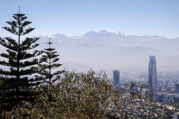
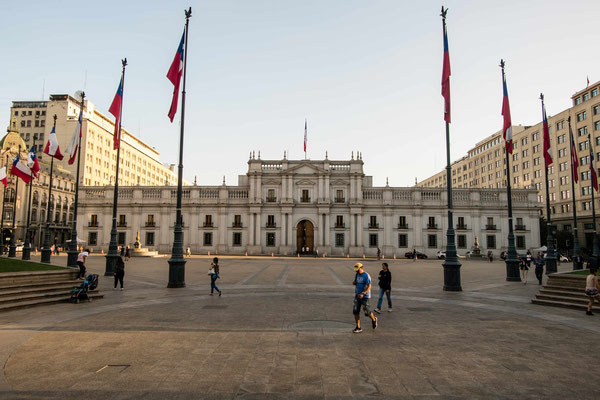
As we reached Santiago de Chile again, we were back in the hot summer. Remember, we came from the European winter, went into the starting fall of south America and ended up at 30 °C in Santiago de Chile while trying to reach the even so hot valleys below the slopes of the Cerro El Plomo.
We were rushing our time quickly in the city of Santiago while looking for a gas cartridge (for cooking/ boiling water). It took us almost half a day to find a brand new equipped small outdoor-shop in the 3rd floor of a random building somewhere far from the city center. It seemed like, that the Chilean people don't go out camping that often.
Santiago de Chile


Anyway, we took one taxi from Santiago to the entrance of the national park of Yerba Loca. So to say, we started right on the feet of those mountain ranges we want to climb the upcoming five
days. At the entrance of the national park "Santuarino de la Naturaleza Yerba Loca", we five had the chance to hop on a jeep of one of the park rangers.
And so we did and reached our predefined goal of the day already on midday.

Christian and I decided to start our own "acclimatization program": very day, we started to hike on every exposed reachable mountain around us. And this, resulting by our "cleverness", caused us huge headaches every time we went back down too fast from one of the mountain tops.
And we started those mountain ascensions right away from our first camp at Yerba Loca to the mountain Cerro Manchón (3720 m) - where we ended up about 100 m in height difference below the top (because of headache and time trouble in reaching the camp before the darkness).
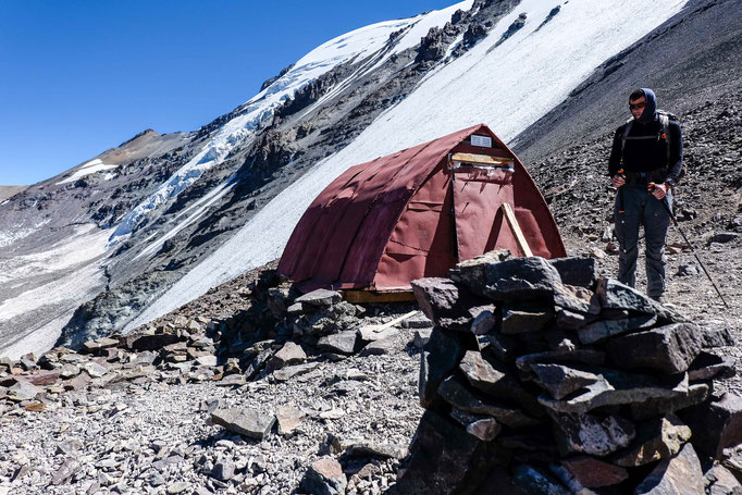
However, we did our whole group - acclimatization program very smooth. That means, we overcame not more than 1000 m in height each day: Stage 1 (15.02.19) at Yerba Loca (Camp site) on 1950 m in height, Stage 2 (16.02.19): La Parva bike park (2950 m), Stage 3 (17.02.19): Piedra Numerada (3350 m), Stage 4 (18.02.19): Base Camp of the El Plomo - Féderation (4150 m).


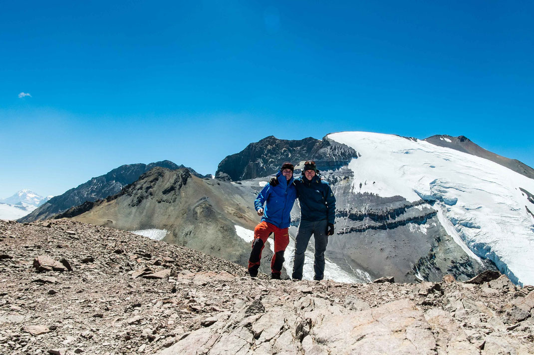
Christian, Benno and I did not went straight forward. As mentioned, we tried to reach the reachable mountain tops on the way up. So we hit the Cerro Falsa Parva (~ 3850 m) during stage 3 and the low technical mountain Cerro Leonera (4954 m) after stage 4 at the 19.06.2019. Our highest mountain ever until this day - and only topped by the ascension of the Cerro El Plomo itself the other day.
The three mountain ascensions on the way to the Cerro El Plomo:
Cerro Manchón (3720 m) | Cerro Falsa Parva (3740 m) | Cerro Leonera (4954 m)


Otherwise, we had a very calm way up to the base camp. The most weird things were of course the bike park above the 'industrial' touristic village La Parva itself and the headaches. We hit the
right weather window with only blue sky during the time of the day, we did our hikes. Of course, during the afternoon, the alpine typical weather changes occur and the clouds arise to the high
sides of the mountain flanks.
We met several kind people on our way. For example the one Chilean teacher at the base camp of the El Plomo, who told us, that he'll just climb the mountain by himself - just the day he arrived
from the city. Because, he had to go back for lessons the day after.
Another "fail of the stay" at the base camp was, that probably the wild fox or a random bird bit into the guidelines of my tent and destroyed those. Maybe, it's been this bird, who found the overcooked pasta (which was only a pile of dough after cooking, though) the day before and wanted to revenge the bad food it ate.
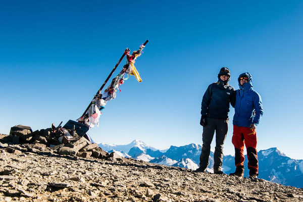
In the end, the whole excursion was only half successful, because our group of five mates had to split up the day we reached the top of El Plomo. You could have seen that prob. at the pictures: the most times, it's been only Christian and me, standing somewhere on top. Mathias, Benno and Finn weren't in the right condition to compete against the height. It was better for them to go down before everything becomes worse (e. g. height sickness).
El Cerro Plomo (5424 m)

We write the day X, it's the 20.02.2019 and Christian and I want to complete our biggest dream until now to reach the first mountain with an absolute height of more than 5000 m above sea level.
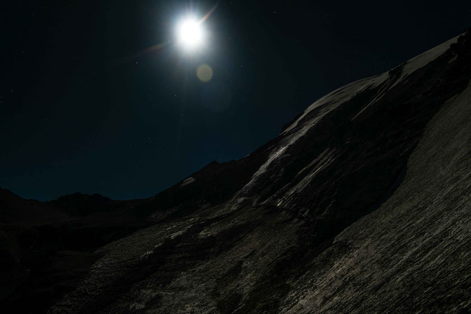
It's 3 a.m. in the night, it's dark, cold, in a freaking height of about 4000 m. We're alone, Christian felt sick, we had almost no sleep the last night, whizzing thoughts running through our heads. But, our eyes stood concentrated at the only reference in front of us: the shimmering white glacier on a perfect cone shaped Cerro El Plomo under a cloud free night of a full moon . At least some light.
Otherwise, we're alone.
We knew the way up, we saw it plenty of times the day(s) before, on the Cerro Leonera, on pictures and from the base camp of course. But, there is something, what stops you doing this. It might be the good sense of your own humanity, or the night, or the fact, that you might have to go alone up on one of the highest mountains of the Andes if Christian's sickness increases.
There's always a will and a kind of responsibility to fulfill the goal - to reach the mountain top - for yourself and for the rest of the group, which weren't able anymore in the end.
And so we walked. Christian and I, the common way - thousands of people went before us. But still, we're alone up here, enveloped by the dark and the upcoming gale winds. Nobody.
We reached the only wind shelter on our way up, went into the shelter; Christian was really sick. He didn't wanted to do any more steps then to this point. The storm was yelling already outside
and kind of knocking on the door of the wind shelter.
I fixed my partner, saying: "We don't have to, it depends of your scope". He nodded, saying that he will follow me.
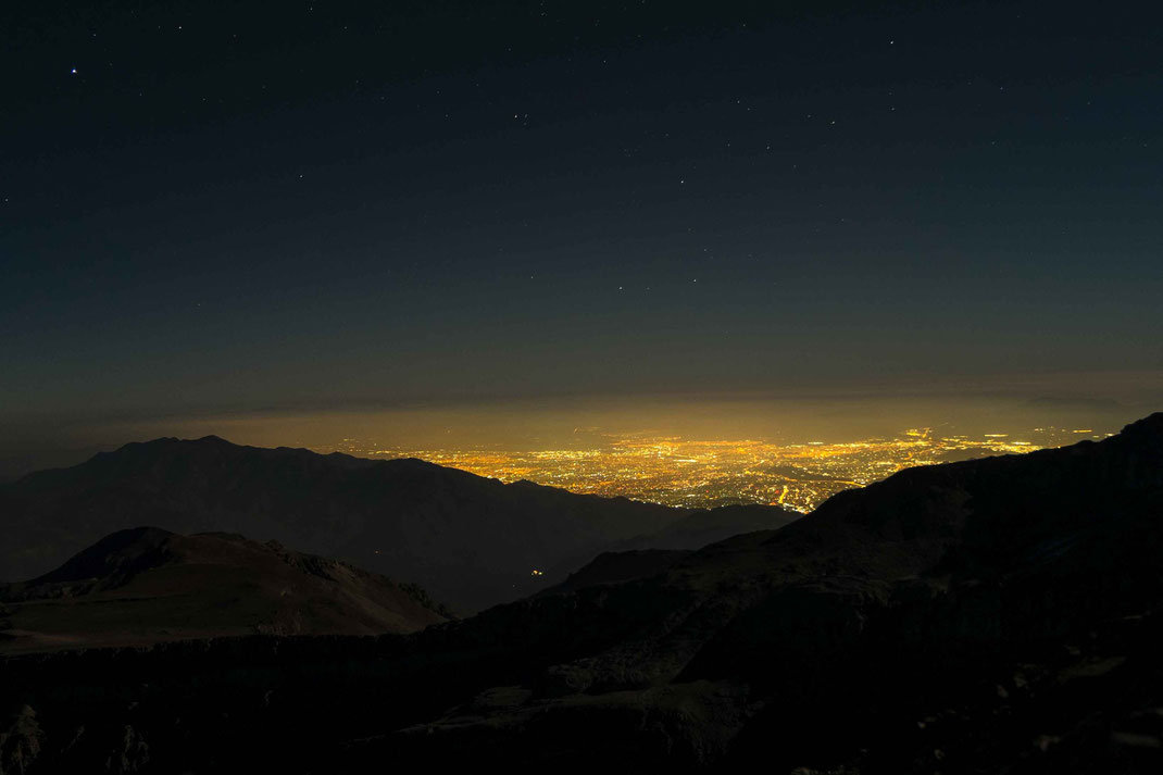
And so we walked. Nobody, except far lights of a city with millions of people - probably sleeping in their beds. They would never recognize, that there are two humans out there, trying to ascent the Cerro El Plomo. It is calming and a nice view, up from here - down to Santiago.
In the end of this day, we found out, that we were the only ones, to go on the Cerro El Plomo. A group of Chilean didn't followed us, as proposed, but went down from the base camp as they experienced some kind of height sickness too.
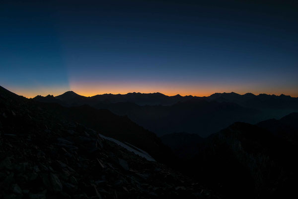
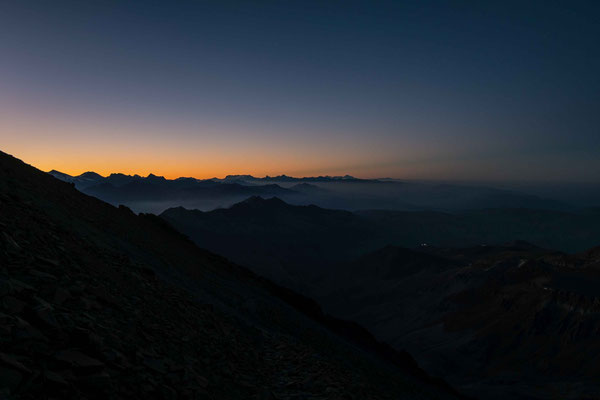
Suddenly, there was a gloom on the sky. The sun!
Blurred edges of the neighbored mountains became visible. The darkness will disappear in some minutes, I thought and took a look over the shoulder to sea Christian who slowly but steadily but his
feet in front the other. And with the flashing daylight, the motivation came back into our minds, pushing us forward the last 500 m in height to reach the highest point of our lives.

We made a stop in front of the only ice field with penitent ice formations, which crosses our path. Those penitent ice formations are unique and can be only found in the Andes because of the special dry climate. They were described at first by Charles Darwin in the 18th century.

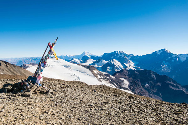
Half past nine, we reached the high plateau of the Cerro El Plomo, experiencing a gigantic view across all the other mountains and a gigantic wind from the NE, which almost blew us down again from the plateau. We faced no more difficulties on top of this wide and long shaped plateau except our tiredness. Neither a body tiredness, more mentally exhausted. It's been an automatic walking mode with a lot of those whizzing thoughts in your head. It is a very unhealthy height, where we walked. And we felt this.

We had no will anymore to stay up here. The view or panorama was astonishing. However, suddenly we felt no emotions anymore for that, what we did 6 hours long before. We just wanted to go back down.
And as we reached the top, a feeling of sadness and happiness in one single second squeezed our minds: we realized, what we managed the days before, we realized, where we are standing on, and we realized, that there are so many more important things than standing in the height zone of death. We just wanted to go down - as fast as possible.

And with all care and left over attentiveness, we slowly walked down; experiencing an increasing type of headache with every step we did. We did not know, what we did wrong. Maybe, we did not took up enough water, walked to fast down, did not breath intense, when we walked down, or had been already sick, as we walked up, or it's been the mountain climbs the days before. We don't know.


We somehow made it until the early afternoon (around 1 p.m.) and just felt into our sleeping bags in our tent below a glazing sun at incredible hot temperatures, we felt so. At 4 p. m., we motivated our-self's do go down further to reach the others, staying at Piedra Numerada.

At our camp site of Piedra Numerada (at a "relaxing height" of about 3500 m), we had the best sleep since we arrived in Chile.
The day after, though, we walked down to the bike park again and waited for a greedy taxi driver, bringing us back to Santiago de Chile.
The evening was short: we went into a Peruian restaurant, ordered one Pisco Sour and (at least I thought so) became drunk immediately. There was no chance. Maybe, that's been the reason, I got a flu the day after. However, we had one more day in Santiago.
We used this day to find the grave of Erich Honecker (which we sadly not found - they removed it somewhere out of Santiago). We flew back the day after, loosing our luggage in Canada and arriving in Munich the 24.02.2019. (The luggage was sent to us the 25.02.)
The Attendees of the great trip to the end of the world
