The Haute Route: Chamonix to Zermatt

On top of our dreams to reach our first 4000 m high mountain in life: the 'Dom' (4545 m). The Haute Route before was just a perfect intro into high alpinism
Am Gipfel der Träume und unseres ersten 4000er: der 'Dom' (4545 m). Ebenso die Haute Route davor war einfach eine perfekte Einstimmung in den Alpinismus.
The Haute Route (21.-28.08.16)
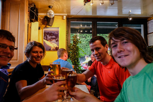
We, that have been Lydia, Christian, Markus and I met each other in Geneva at the 20.08. Originally, we started our trip from different locations to get there (except Markus and I, we came from Darmstadt).
We spend the night from 20. to 21.08. in Chamonix in a hostel and started the next morning at 6 o'clock by bus to reach our initial starting point of the Haute Route (Le Tour).
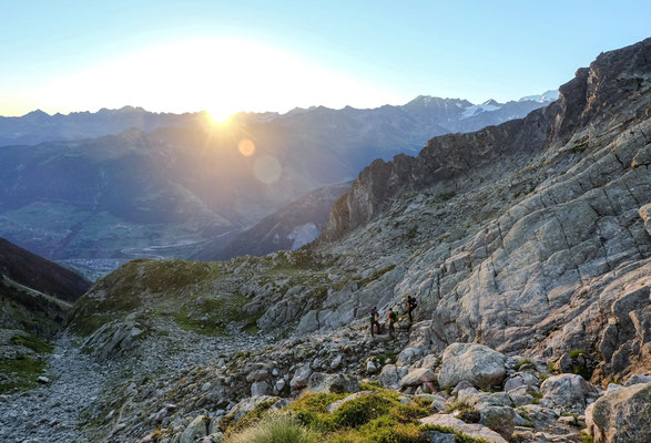
From Le Tour, we went up a steep hill, crossing a thick fog, passing grazing cows along the imposing monument of the Mont-Blanc.
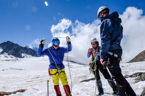
After a few hours, we reached the first and the last alpine French cottage of the Haute Route, Refuge Albert 1er. So, we had enough time to recapitulate our old knowledge about winter mountaineering at the glacier (Le Tour) in front the house door.
Wir, das waren Lydia, Christian, Markus und Ich trafen und am 20.08. zusammen in Genf. Alle hatten wir eine weite Anreise von verschiedenen Orten (außer Markus und ich von Darmstadt).
Wir übernachteten in einem Hostel in Chamonix, von dem wir am nächsten Morgen um 6 Uhr mit dem Bus zum Startpunkt unserer Tour (Le Tour) aufbrachen. Von Le Tour ging es steil bergauf, durch dichten Nebel, vorbei an grasenden Kühen gegenüber vom imposanten Mont-blanc Massiv.
Schon mittags trafen wir ein auf der ersten und letzten Französischen Berghütte (Refuge Albert 1er) unserer Hochtour (es war natprlich nicht der letzte Ort, an dem Französisch gesprochen wurde). Der Nebel war schon lange aufgezogen und ermöglichte uns noch einmal eine schnelle Rekapitulation des erlernten Verhalten zur Gletscherspalten-Bergung auf dem Gletscher Le Tour vor der Haustür.


The way up to the Haute Route


Refuge Albert - Cab. D'Orny - Cab. Valsorey (22.-23.08.)
Ref. Albert 1 er - Cab. D'Orny
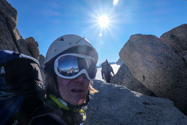
From the Ref. Albert, a straight way up on top of the Glacee Le Tour went to the edge of the mountain plateau (and country border France-SUI) "Col Supérieur du Tour". Originating from this location, we hiked up to our highest point so far, the "Aguille du Tour": 3540 m).
We climbed down this top, put on our crampons again and went down in perfect weather and good ice/ snow conditions, to the second cottage Cabane D'Orny.
Cab. D'Orny - Cab. Valsorey
In the early morning at 5 o'clock, we stood up matress dormitory and ate our brakefast. It should be said, that I brought my own food all the way for the first three hiking days. So by backpack weighted about the double as of the others. But it paid off, I saved the half of the money, and the nature makes it worthy, to take some extra burden.
Our start delayed as Christian had headache. No good start into the 2nd day of the trip, but finally, we started. A long descend down into the valley to Champex. In Champex, a nobly village, our bus to another village (Bernard) brought us to the slope of the mountains of the Grand Combin.
We did not went up this difficult reachable mountain top, but to the cottage "Cabane Valsorey" on the valley counterpart. The way up to this cottage seemed endless, hot flirting temperatures and a steep slope with a big load of luggage on the bag made it to one of the most exhausting parts of the full trip.
But we reached it anyway and enjoyed the end of the day with an unforgetable view into the wide valley.


Cab. Valsorey to Cab. Chanrion (24.08.)
Quite early at 3:30, we stood up and went out to find the right way to the "Glacier du Meitin" and right the way to the "Bivouac du Musso". The sun was already long time above our heads, when we reached the last named location with a dealy of approximately 1 h. The ascend was long and heavy with increased difficulty, finding the right way through the gravel & ice fields on a pretty steep slope.
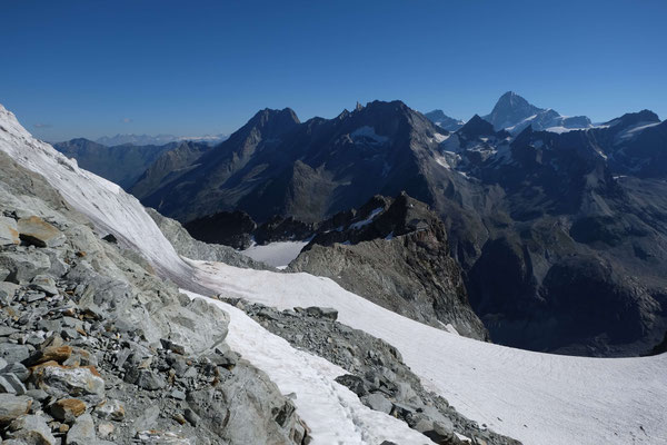
At 8:00, we stood on top of the plateau close to the "Bivouac du Musso". The morning sun revealed a wide and clear view to the next mountain tops, as well the Matterhorn on the horizon. Our long way to the last point of the high alpine tour.
In progress of this day, we hiked down the enourmus glacier of "Mont Durand" (close to the Italian country border). Last but not least, we'd to go up again from the valley of the river"Dranse de la Bagnes" to reach the fourth cottage, Cabane Chanrion.
As we felt pretty hot because of the long hike, we went for a short swim in a very cold small lake closed by.


Cab. Chanrion - Cab des Dix - Cab. Vignette (25.-26.08.)
In the morning, we passed by this cool lake, where we took a swim last evening. It acted like a perfect flat mirror, showing all the reflections of the growing morning sun from the opposite mountain range.
The next 3 hours belonged to a long and demanding ascend to a glacier plateau. Originated from this plateau, the way done to the cottage of Cab. des Dix was just a "some" steps, but passing by a huge slope glacier. When markus told us, we gonna walk on this tomorrow morning (in the darkness), I thought, this was a joke.
But like we figurred out the next morning, this slope glacier (Cheilon glacier) had an easy to access part on the northern part (in direction of the cottage).
So we went up, overtook a group of Swedish people and reached the Pigne d'Arolla at 8:15 o'clock. From there, the way down to the next cottage (Cabane Vignette) was relatively fast and easy, but steep. But we'd been early in time, before the sun melt the snow to a slushy substance.


Cab. Vignette - Cab. Bertol - Schönbielhütte (27.-28.08.)
Cabane Vignette to Cabane Bertol
It was still dark, when we walked away from the Vignette cottage. But as we reached the lower plateau (luckily, with still frozen water puddles), the sun was bright enough so that we switched of the headlamps.
Basically, we surrounded the island like mountain top to reach the valley with the wide slope glaciers. This took us a while and even as it was going down all the day, we became tired. We still kept in mind, that we've to ascent the Cabane Bertol over a very long snow covered slope. The snow there was soft and itchy, which slowed us down and increased our anticipation to reach the Cabane Bertol. As this wasn't enough of a steep rise, we finally had to climp over several ladders to reach the on a high rock throned Cabane.
Cabane Bertol to Schönbielhütte
We woke up at 5 a.m., where we'd been one of the first. Sadly, we where one of the last groups, leaving this exposed cottage. Leaving during the arising sun was the better option because of a pretty steep and slippery climbing path from Bertol down to the snow field.
Today, I went in front of our 4-man group. We overtook almost all other mountaineers on our way up to the highest elevation of our whole trip until now: the Tête Blanche. However, standing on this top, our eyes slided to a more remote place about 45 minutes away. Spontaneously, we decided to ascent this one, too (the Tête de Valpelline, 3802 m). Btw., this one was a bit higher and provided a brilliant view to the famous Matterhorn and Dent d'Hérens.
After a short but refreshing stop on top of this mountain, we hiked down to the snoud of this glacier, following several traces of other mountaineers through the labyrinth of glacier fissures.
When we reached the end of the glacier, the Schöbielhütte was just a step away. It seemed so. But, the way down along the rocky hill Stockji was pretty difficult. We were lost for a while. Finally, we made it with a delay of 1 h to reach the gutter, which was washed out from the old glacier.
The worst part came after that: When we crossed the gutter, we had to climb up through steep increasing a field of loose gravel. These gravel blocks were situated on top of an layer of ice. Therefore, this resulted in the most difficult ascent to a cottage of the whole trip.


Schönbielhütte to Domhütte (29.08.2016)
After the cozy night in the Schöbielhütte, we went down from this cottage to the valley and Chamonix in the early morning. The first high civilized place since 7 days. It felt strange, to see so much people. Especially to see this rich and famous town, a huge conrtrary in comparison to the remote and silent glaciers.
Our further vacations can be count to about 1 one week. Our plan was, to reach our first at least 4000 m high mountain. We checked the weather for the next 3 days and decided to go on top of the mountain "Dom" (4545 m).
After a small lunch, we took the train to the village Randa. Originating from this place, we climbed up the steep mountain slope to the Domhütte. As the weather today was warm with a high humidity, the sweat was running down in streams from our faces during the way up to the "Domhütte".
Exhausted, but happy, we reached this cottage in the afternoon and enjoyed the view into the valley. We went to bed early as every day; the next day will be hard and long - our first 4000 m high mountain top in life!


Domhütte to the mountain top of the Dom (30.08.2016)
It fel like routine, to hear the ringing clock at 3:00 in the morning, to stand up, eat something and go out of the house for another mountain adventure. This counts as well for this day.
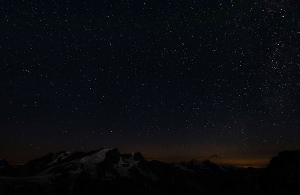
The first time during the last 1.5 weeks, we'd a cloudy sky, far weather lights were flashing the dark night in scary moments to some bright moments of concerns of our today project. The way to the glacier felt strange and long, lucky we, we had another mountaineer group from Germany in front of us, guiding us the first few meters to the glacier. The Festiglacier: a huge monument, covering the full part of the high mountain "Dom", leading us to the top of this cool guy.
After long 2 h over loose gravel fields, we reached the Festiglacier. The lower part of this glacier was dangerous, as it contained a bunch of huge crevasses.
In combination with the darkness, we felt the lack of routine in mountaineering, to feel safe on this ice cap.


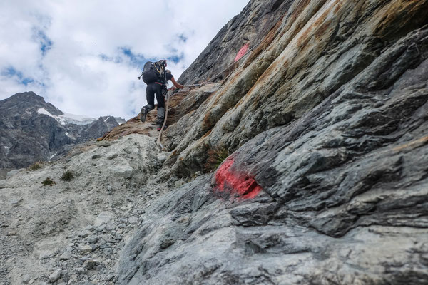
When we reached the end of the Festiglacier, we met a small rocky mountain, the Fetijoch. At this point, we had to climb over the this hill in sports climbing style (about a 3+ in difficulty).
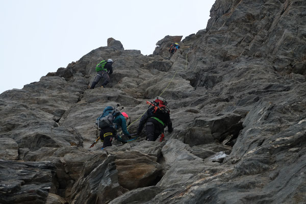
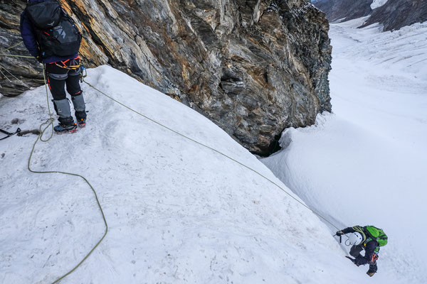
A huge crevasse was waiting for us on the other side, where we had to repell with much patience! A lot of time, to watch the other group in front of us, managing to cross an impressing part of the glacier. From the right, big ice blocks will fall down time by time (esp. during midday, exposed to the sun).
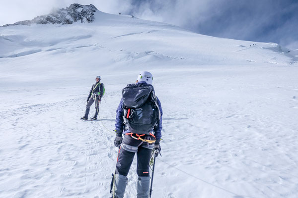
We're late. A delay of about 1.5 h made it not easy in respect to our group dynamic, to keep calm. When we managed the climbing part, the steep ice and soft snow covered mountain top of the 4545 m high Dom was waiting for us.
We felt the height, we crossed the magical 4000 m barrier, lungs and hearts were punping and every step took us a while. this was an important exame to us. We pushed ourself as a group forward, supporting individual losses of power as we'd been conected to one rope. Soon, we reached the group infront of us.
And suddenly, just listening the to the steady breath of our lungs and watching carefully our steps, we stood on top!


Man, we stand on top of a 4545 m high mountain, a panoramic view like out of an airplane. Even the poor guy Matterhorn has a lower top then our mountain. All the serotonin and other hormons of fortune rushed suddenly through our blood vessels. All the pain of the last 5.5 h was far behind in the last corner of our minds. Pure happines! Hand shake and hugs and just enjoying this seldom view at fantastic weather in sun.
This is the point, the weather. Never forget about the weather, because we do have summertime! The sun has an incredible force, causing the melting of this huge icy blocks, where we're standing on. This means, we should go now, as we've to cross a valley with all where all the loose ice blocks could fall into. We went down, just 15 min later after our arrival on top of this mountain. This time felt so short, but it is necessary. No we know, how it feels, standing on a higher mountain, where the weather window is much smaller as ours.
We went down, carefully, not risking a sudden slide on our butt on this steep part of this mountain. We passed by several huge crevasses, passed this scary passage through this valley where the ice blocks could fall down, climbed over the Festijoch and hiked down the Festiglacier. Wow, even the way down took us about 4 h.
This whole adventure felt like a rush, and we still have early afternoon. We decided, not to hike down from the Domhütte, but to rest and enjoy the view and the feeling of tired legs. Increadible day!


Domhütte to Fluhalp (31.08.2016)
To be continued.